Rhode Island has a surprising amount of hiking packed into it. We tallied up each hiking location’s average monthly Google searches and then interviewed local hiking experts about each place.
Please note that although you can hike at all of these locations, many restrictions do apply and you should check the official website for each location before you try to go hiking there. Make sure to follow all of the guidance that is advised by any entity that is taking care of each location.
Also, Explore RI put together a good list of tips about how to safely hike during COVID.
The experts we spoke to are:
Jeanine Silversmith, Founder and Director of RI Families in Nature and Author of The Rhode Island Family Hiking Guide and Journal
Megan Fischer, Director of Roger Williams Park Conservancy
John Hirschboeck, Commission Member of Newport’s Cliff Walk Commission
Roy Najecki of the Glocester Land Trust
Jessica Willi, Executive Director of Block Island Tourism Council
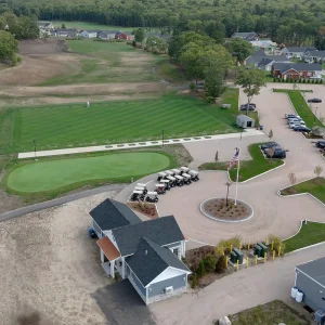
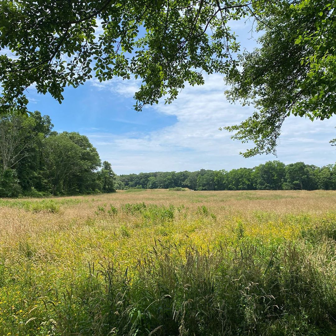
1. Roger Williams Park
3,200 Monthly Google Searches
COVID-19 less popular alternative: Belmont Park
Check here for the latest COVID advisories before you go.
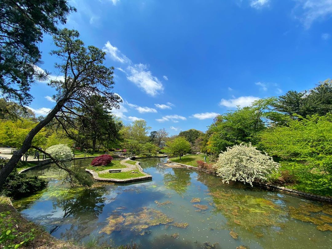
Jeanine: Roger Williams Park is truly the people’s park. It offers wonderful opportunities to view wildlife, interesting old trees, flowers, and natural areas along the five amazing woodland trails.
Megan: Thanks for including Roger Williams Park. You can find maps of the Park’s walking paths and trails on the Roger Williams Park Conservancy website. The Big Lakes Trail (3.2 miles) is particularly scenic, as it winds along the shoreline of the Park’s ponds.
The Providence Parks Department asks that any visitors to the Park follow safe social distancing practices, allowing 6 feet of space between one another and avoiding gatherings larger than 5 people, and that they carry out any items or trash they bring with them.
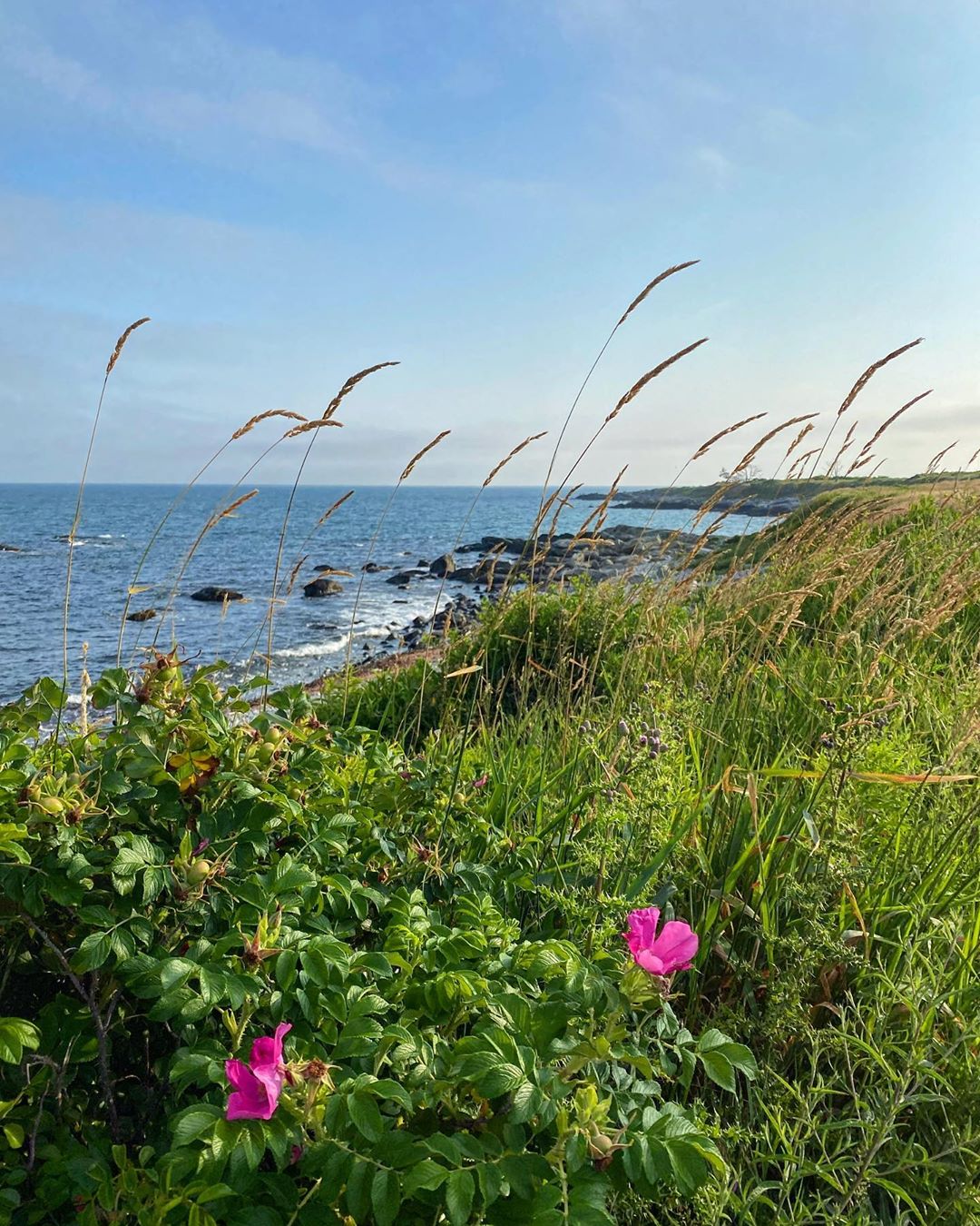
2. Cliff Walk
3,200 Monthly Google Searches
Check for any COVID advisories on the official City of Newport website before you visit Cliff Walk.
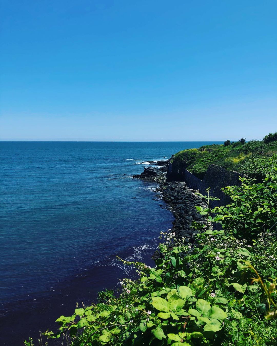
John: The city of Newport is concerned about excessive use of Cliff Walk because it’s a bit narrow. It usually attracts thousands of people. It’s RI’s #1 tourist attraction with over a million visitors to the walk every year. We have a trail marker program that we introduced, and you can connect with your phone and learn the history of what you’re seeing on the path. On the left side you can see into Massachusetts and on the right side you can see mansions that have interesting historical and architectural features.
It’s the only national recreational trail in a historically preserved city. So it combines both the beauty of the ocean and the landscape as well as the history of the city, primarily from the gilded age.
Until this virus blows over, walk early or walk late, and practice safe distance.
Two alternatives to Cliff Walk are:
Bay Path: Goes through Newport, and extends all the way around Fort Adams. The water’s always on your right side, and it heads all the way to the Eisenhower House and then back. There are fishing opportunities, barbecue pits, and it’s not very crowded. It’s right near where the Newport Film Festival is every July.
Aquidneck Land Trust: They are based in Middletown, RI and have some great hiking trails. The trails are very wide, so they’re encouraging people to come up.
Jeanine: [Cliff Walk] is breathtaking. It’s right on the water, it’s stroller and wheelchair friendly. The spring is the right time of year to go as long as you bundle up, it’s hard to find parking in the summer around there. It has different sections to it. From Memorial Boulevard to Salve Regina University is the most popular stretch, so pick up the path a little further because it’s less crowded. The views are so amazing with the ocean waves crashing down below, you have a true sense of the island over there.
3. Burlingame State Park
2,400 Monthly Google Searches
COVID-19 less popular alternative: Richmond Heritage Trail
Follow this page for updates before you visit.
4. Norman Bird Sanctuary
2,000 Monthly Google Searches
COVID-19 less popular alternative: Dundery Brook Trail
Check this page for updates on COVID advisories before you visit.
Jeanine: There is a small trail fee, but with ten different trails, there’s something for everyone. Enjoy a leisurely stroll along the Quarry and Shady Glade Trails or hike the steep, rocky trail to the top of Hanging Rock for an amazing view of the ocean. Either way, you’re certain to see or hear a song from one of the many species of birds who make their home there.
5. Goddard Park
1,700 Monthly Google Searches
COVID-19 less popular alternative: Scalloptown Park
Check this page for COVID updates before you visit.
As of April 3: “DEM asks the public not to drive to parks and beaches. The entrances will be blocked, there is no public parking, and these facilities are closed to vehicular traffic. DEM is not prohibiting Rhode Islanders from walking or riding bikes at parks and beaches if they are not congregated in groups of five or more and are adhering to social/physical distancing rules to prevent the spread of COVID-19. DEM will be patrolling these sites and dispersing groups of people.” Follow this page for updates.
Jeanine: It’s really easily accessible. You’re on Main Street in East Greenwich and you turn a couple of corners to get there. It’s easy to have a picnic and see the water, but I urge caution with the trails, because they’re not all well-marked.
6. Mohegan Bluffs
1,200 Monthly Google Searches
Check the official Block Island website before you visit for COVID updates.
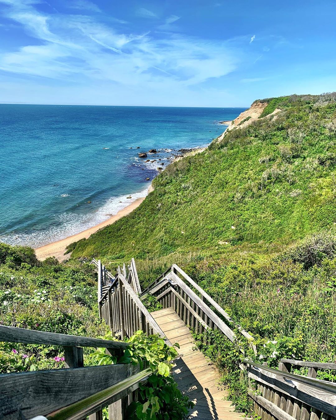
Jessica: You can drive up, because the island is so small, and there’s a spot where you can pull off the road and put your vehicle. You can walk a short 20 or 30 yards to an overlook where you can look out over the cliffs, or you can walk down the stairs, about 240 of them, and they take you down to the beach, and then you can climb up the stairs when you’re done.
Block Island is just under 50% preserved open space. We have a long trail network of walks throughout the island called the Greenway Trails. Mohegan Bluffs is probably the #1 most visited place because of the southeast lighthouse sitting atop the bluffs. It’s an incredible vista, it doesn’t look like anywhere else in RI, it’s a really spectacular view. You’re on top of 200 foot cliffs that drop into the ocean.
Once this is all passed, it’s definitely a nice place to get outside and walk down the stairs.
Jeanine: If you’re on Block Island and don’t have a car, you have to get there from the ferry with a bike or a long walk. It’s not much of a trail, you walk down the long staircase and you’re on the beach. It’s more of a beach destination right by the Southeast Lighthouse, and that’s lovely.
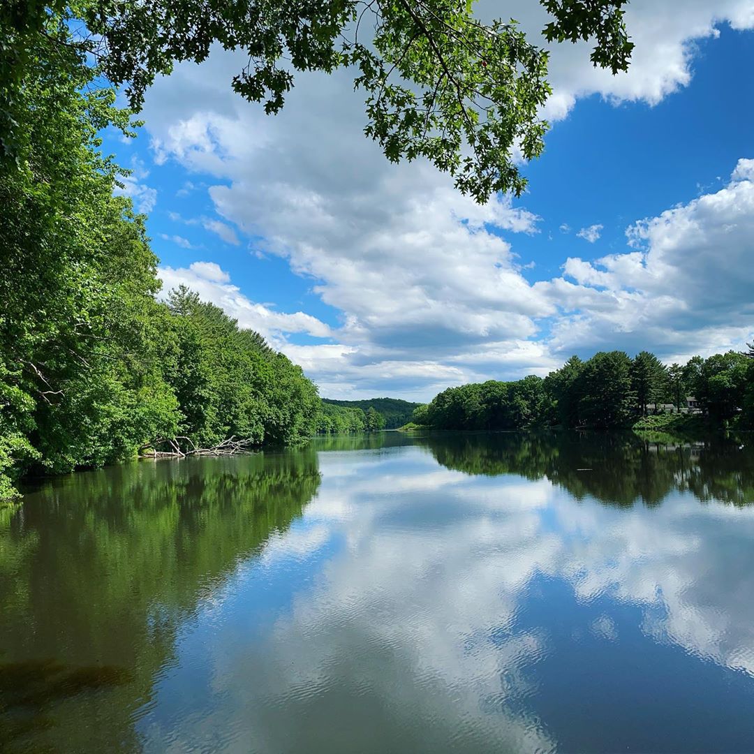
7. East Bay Bike Path
1,100 Monthly Google Searches
Check for any COVID advisories here before you go.
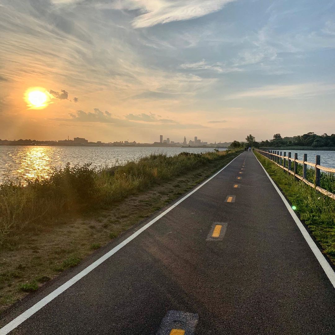
Roy: Really popular, I’ve been there many times. It’s more of a bike path than a walking path, although people do walk on it. For birdwatchers there are views of nature preserves and wetlands along the old railroad right of way, and great views of Narragansett Bay. It is one of the most popular places in the state to ride a bike and ends at the Bristol waterfront.
8. Sachuest Point
500 Monthly Google Searches
COVID-19 less popular alternative: King/Benson Preserve
Check here before you go.
Jeanine: Everywhere you turn is a sweeping view of the ocean. It’s almost like a crushed rock path, so it’s stroller and wheelchair friendly, and there’s very little elevation. There’s a visitors center there ordinarily, and they can have arts and crafts set up for young ones and toddlers, and there are a couple of trails you can take.
9. Jerimoth Hill
500 Monthly Google Searches
COVID-19 less popular alternative: Little Rhody Vasa Park
Check here before you go.
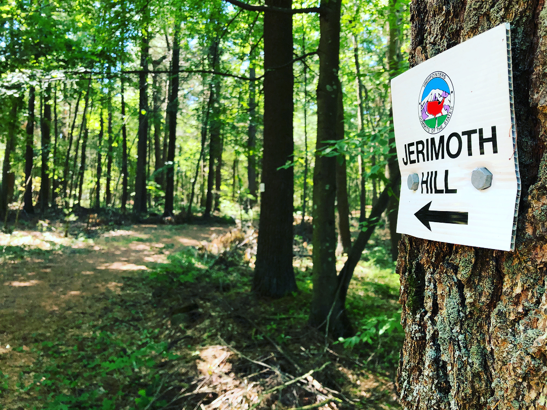
Jeanine: Leave it to Rhode Island to have a highpoint a mere 812 feet above sea level and getting there involves almost no elevation gain! Still, reaching the highest point in RI grants a certain degree of accomplishment and could be the start of a family’s highpoint adventures.
Roy: This is not really a hike as it isn’t longer than 100 yards. But a well worn and marked trail on the south side of RI Route 101 leads to a rock about a foot above the ground which is the highest point in Rhode Island.
10. Lincoln Woods Trail
400 Monthly Google Searches
COVID-19 less popular alternative: Quarry Road Trails
11. Stepstone Falls
250 Monthly Google Searches
COVID-19 less popular alternative: Wickaboxet Management Area
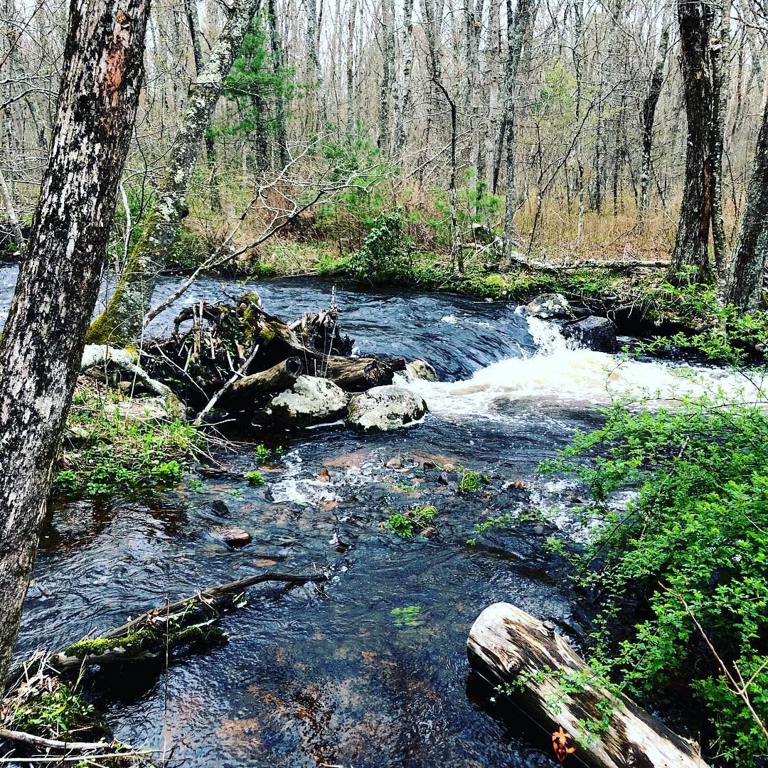
Jeanine: I love that trail! Anytime you go there it’s a little different, it’s nice to retreat to. They’re tiny falls, and it’s a nice length, about three miles or so. There are cool features along the way… there’s an old sawmill there and great spots where kids can play along the rocks and in the water and stuff.
Roy: One of the more popular places to walk in Arcadia and RI in general. It follows the Falls River, and it has very nice scenic views. The river flows over granite ledge rock that had been quarried 100 years ago for building materials. It’s very scenic, easy to walk, gently rolling. Start at the small parking area at the north end on Falls River Road, and from the east side of Wood River walk south on the blue and white blazed trail. This is a combination of the North-South Trail (blue) and River Trail (white). A wood bridge takes the trail over the river for a scenic view. Continue south and the trail blazes become blue and yellow (Ben Utter Trail). Along the route you will see granite vestiges of an 1800’s saw mill. The Ben Utter Trail ends at a wood bridge at the gravel Austin Farm Road. Turn right (west) onto the road for 100 feet and enter Tanner Washout Trail (a wide gravel road with faded blue blazes) and walk north. Tanner Washout Trail ends at a crumbling asphalt access road. Turn right continuing north and arrive at the 1930’s Civilian Conservation Corp pavilion with a nearby outhouse. The pavilion was restored in 2016 by volunteers of the Narragansett Chapter, Appalachian Mountain Club. The pavilion has plenty of picnic tables. From the pavilion follow the yellow blazed Ben Utter Trail north to parking area. You can do it all in an hour and half max.
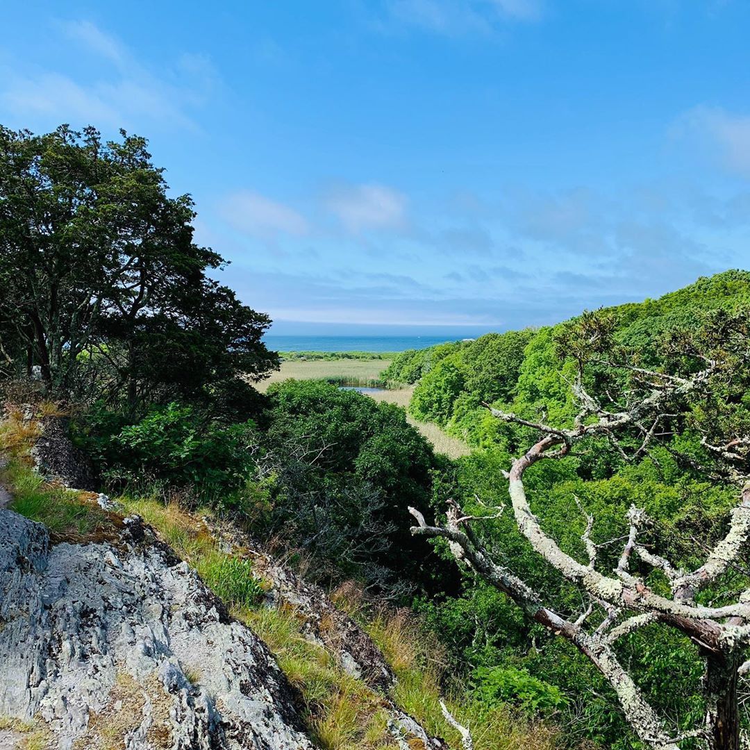
12. Arcadia Management Area
250 Monthly Google Searches
COVID-19 less popular alternative: Richmond Heritage Trail
Jeanine: This is a great spot to go for lots of different reasons. There’s so much to do, and you can find those longer trails that people look for there. My favorite places are Breakheart Pond, Browning Mill Pond, and Stepstone Falls. There’s also an accessible trail that’s really short, at Upper Roaring Brook. It’s about a half-mile – great place to strollers and wheelchairs right in the heart of Arcadia.
Roy: The AMC Narragansett Chapter maintains 50 miles of trails in Arcadia. Those are the trails that have painted trailblazes on the trees. There is 100 miles more of trails that have been created by mountain bike, equestrian, and motocross groups that are not marked. If you’re not careful, it can be easy to become disoriented and lost. Keep an eye on the blazes. There are some steep sections within Arcadia. It’s a wooded setting, lots of streams. Very popular place for different user groups.
13. Weetamoo Woods
200 Monthly Google Searches
COVID-19 less popular alternative: Fort Barton Woods
Check this page before you go.
Roy: Very popular place on the East Bay with well-marked trails. The local land conservancy organizations are still active in acquiring more land there and protecting it. Very nice, gently rolling walks. One interesting feature is the remains of an old wooden shingle mill along Borden Brook in the center of the woods. Adjacent to Weetamoo Woods is the Pardon Gray Preserve with easy-to-walk trails that go through a rare Oak-Holly woodland.
14. Wolf Hill Forest Preserve
200 Monthly Google Searches
COVID-19 less popular alternative: Connors Farm Trailhead
Check this page before you go.
Jeanine: That’s great if you have history buffs in your group. There’s a memorial to three airmen who died on the site when their plane crashed in 1943. It has rugged pathways which you don’t get a lot of in Rhode Island.
Roy: Near the police station in Smithfield, it’s easy to park there. There are about eight miles of gently rolling trails, though a section of one of them is very steep and you almost have to be a mountain goat to get up there. It was about six years ago that those trails were blazed and marked and mapped. The map is online at exploreri.org. The Smithfield Land Trust maintains the trails well. There’s a superb overlook, Mercer Lookout, at the southeast section of the property from which you can see to Fall River. Along one of the trails is a memorial to the three servicemen who died when their plane crashed at this location during a World War II training mission.
15. North South Trail
200 Monthly Google Searches
Jeanine: I’ve never done it from end to end, but I’ve picked up different parts of it. There’s a group that every spring sends out an email about doing group hikes together for it.
Roy: Most of it is in the woods. You pass through a lot of state management areas. It’s fairly well-marked and maintained with blue blazes on the trees. It’s a trail that you do in eight or ten mile sections and come back and do another section. You pass through a lot of rural areas and backroads.
16. Neutaconkanut Hill
200 Monthly Google Searches
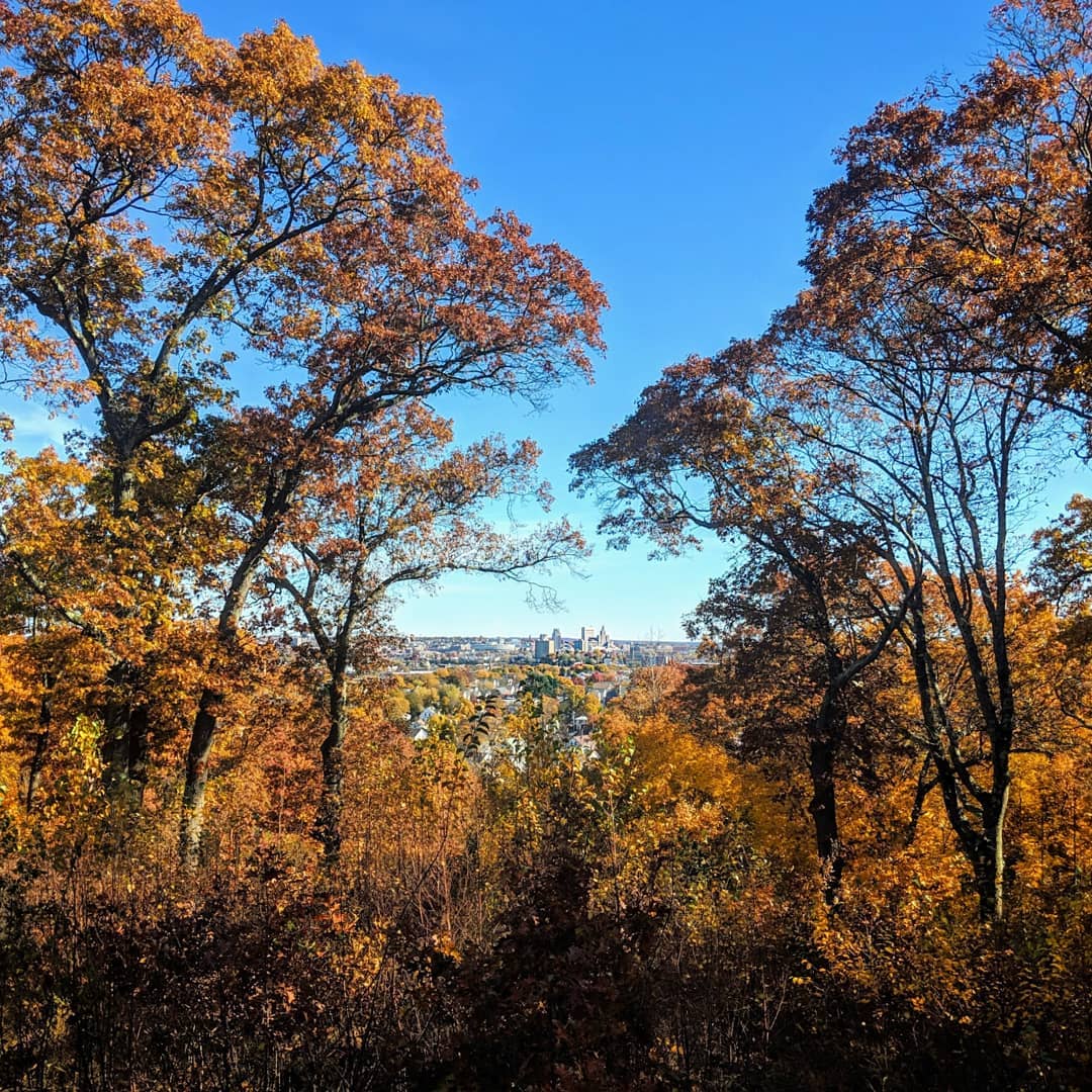
Jeanine: It’s the gem of Providence. It’s somewhere between 80 and 90 acres of real wilderness in the middle of Providence. You get a beautiful view of the city from the top of the hill. There are such cool features on all of the different trails. There’s something for everyone, both short and long trails. It’s one of my favorites. Kudos to the Neutaconkanut Hill Conservancy… it’s gorgeous and so interesting. You can use a bus to get there, you don’t need a car. There’s a playground, a skate park, and fields for flying a kite and picnicking.
Roy: It’s three to four miles of trail on the hill. It’s largely unknown to many people in the state because of its location. But it’s got relatively steep trails until you get to the summit. At the summit is a beautiful vista of downtown Providence from the hill. The hill forms one of the original boundaries of Providence and Rhode Island. Quite a historic view there. Once you get away from the urban park setting at the base of the hill and get up there, it’s hard to believe you’re in Providence.
Source Credit: https://travelwithdata.com/rhode-islands-18-most-popular-hikes-according-to-google/